Two new collections are now available via the University's subscription to Digimap - Geomni and AgCensus!
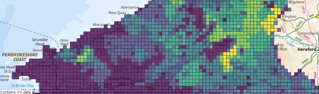 The Agricultural Census is conducted annually by the government departments dealing with Agriculture and Rural Affairs for Scotland, England, and Wales. Farmers are surveyed and asked to declare the agricultural activity on their land. AgCensus provides access to a time series of grid square based data derived from the survey.
Geomni consists of three parts: 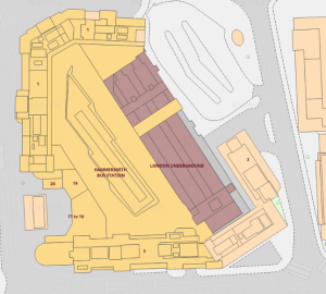
- UKMap: a modern, detailed, feature-rich mapping databases of Greater London.
- UKBuildings: a unique database to help you understand the age, structure, characteristics and use of commercial, public and residential buildings across Great Britain.
- UKLand: a national land information database providing a detailed breakdown of land use across the UK.
Access: On first use you will need to register and accept the licence conditions.
Digimap AgCensus This link opens in a new window Description of this database.
New
Digimap Geomni This link opens in a new window Description of this database.
New
All Digimap users please note the Collection formerly known as Geomni has now been rebranded as Verisk . All data, support materials and access remain unaffected, only the name has changed! Look out for Digimap Verisk.